A brief story of town formations in Phu Quoc island

Duong Dong Harbor Beach
Approximately 70% of Phu Quoc Island has been covered by dense tropical forests and rocky mountains, due to a specific geographical location.
In Dry season, the East side of the island takes the impact of Northeast monsoon whereas the opposite side gets truly calm. When Rainy season comes, things seem quite reverse. The Westside gets intensely heavy under the influence of Southwest monsoon.
Under such a specific condition, besides most of the people on the island in the past were involved in seamanship and for fishing, the best period of time for long-term sea trips is in Dry season thereby there has been the formation of residential clusters that have been developing into crowded towns in riparian areas along the West side of Phu Quoc island in comparison with the Eastside.
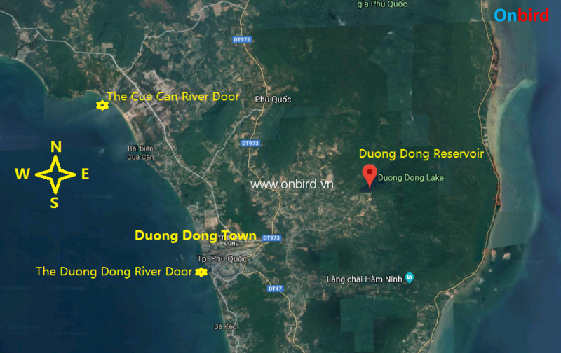
As you might know, not like many other islands, Phu Quoc has not been getting into freshwater supply problems because it can control the supply of fresh water thanks to the presence of a freshwater river system and streams on the island which mainly lies in the Westside.
The heart of Phu Quoc Island is a large reservoir — Duong Dong Lake which is the watershed of the Duong Dong River (the largest river in Phu Quoc) as well as the main freshwater supplier for the whole the island. You might be surprised at the fact that in Phu Quoc there a handful of commercial freshwater producers. At the Duong Dong River door, a residential cluster has been growing into the largest town in Phu Quoc — Duong Dong Town.
—————-
Phu Quoc transformations in term of its towns
The Duong Dong River door is also the shelter to many fishing boats serving for traditional fish sauce factories located along the river, come here you will probably see the scene of a river full fishing boats from Hung Vuong or Nguyen Trung Truc bridge. Or the Cua Can River in Northwest Phu Quoc was home to most of the traditional fish sauce factories in the past in Phu Quoc.
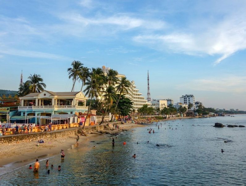
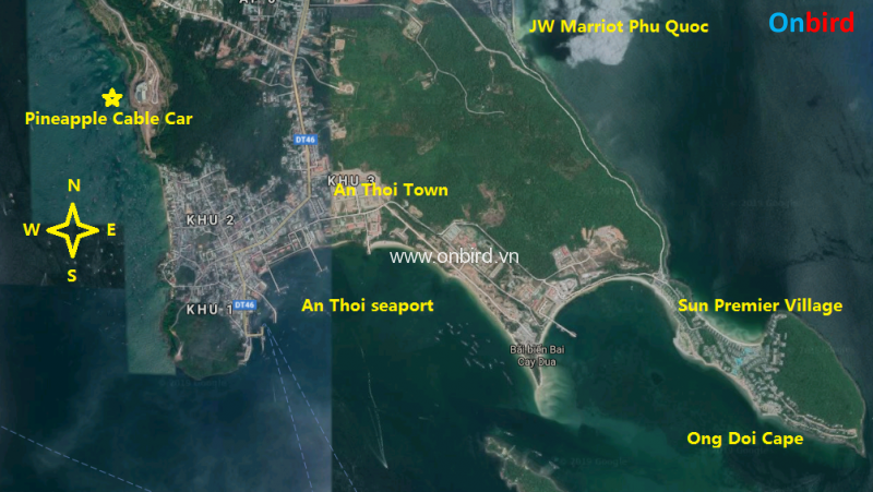
South Phu Quoc Island is also the location of the Southern-most town of Phu Quoc as well as the second-largest town on the island – An Thoi town.
This town is located in a stretch of land joining the Southwest side and the South end of Phu Quoc Island.
Phu Quoc towns - Duong Dong Town - Phu Quoc Experience
Phu Quoc towns – Duong Dong Town – Phu Quoc Experience

——–

Thanks to specific terrain, circling-shaped coastline, this area has been becoming a safe shelter to fishing boats in the whole year from the influence of either the Northeast monsoon or the Southwest monsoon. Thereby the town has been developing the largest fishing seaport as well as tourism seaport in Phu Quoc for hundreds of years. The distance between Duong Dong town and the Southern-most town – An Thoi town is around 30 km, until the pre-2011 period when Phu Quoc hadn’t been connected to Viet Nam national electric system, there was only one small dirty lane joining these 2 main towns in Phu Quoc, that lane went through the dense forest and after a period of time of working in Phu Quoc, many fishermen in An Thoi town once told me that they had never reached Duong Dong town until the age of 20 – 30 since many difficulties they probably encountered such as rugged joining lane, for fear of dangerous wild animals, dark lane, long-time trip (almost one day period)…That sounds as if they were living in 2 completely different worlds whereas living on the same island.


However, nowadays under the massive investments aimed at the development of infrastructure as well as tourism, it is increasingly getting much easier to reach many places on the island by vehicles.
The rise of urbanization on the island involves the formations of new tourist areas along the long coastline of Phu Quoc, typically in the Westside such as Ong Lang Beach – Ong Lang Town, Ganh Dau town, and a beach full of medium-class resorts nearby.
————-
 Duong Dong Harbor Beach
Duong Dong Harbour beach near Dinh Cau Shrine